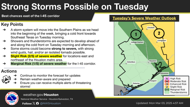
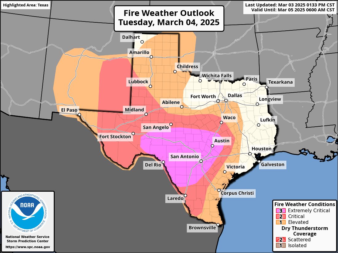
TOMORROW — Extreme wildfire danger across the western third of Texas today will spread east on Tuesday to encompass the western two-thirds of Texas. Specifically, tomorrow may be one of the highest wildfire threat days since the 2011 wildfire outbreaks in the Hill Country, Central Texas, and South-Central Texas (example: Bastrop Complex, other impactful wildland-urban interface events).Very strong, locally damaging winds will increase the probability of tree damage and damage to infrastructure, potentially aiding the ignition of fires. Here’s a new statement for tomorrow in the fire weather outlook: “Widespread sustained west/northwesterly winds of 30-40 mph are expected, with gusts of 50-60 mph possible across much of south-central TX. The potentially historic wind/relative humidity overlap will support widespread critical and extremely critical fire-weather conditions over very dry and heavy fuels loads. Energy Release Components (ERC) and 10 hr fuel moisture values above the 90th and below the 10th percentiles respectively will undergo further drying to near record levels through the day as winds increase. The combination of extreme weather and very receptive fuels will likely support very high-volume initial attack, extreme rates of spread, and uncontrollable fire behavior.”