
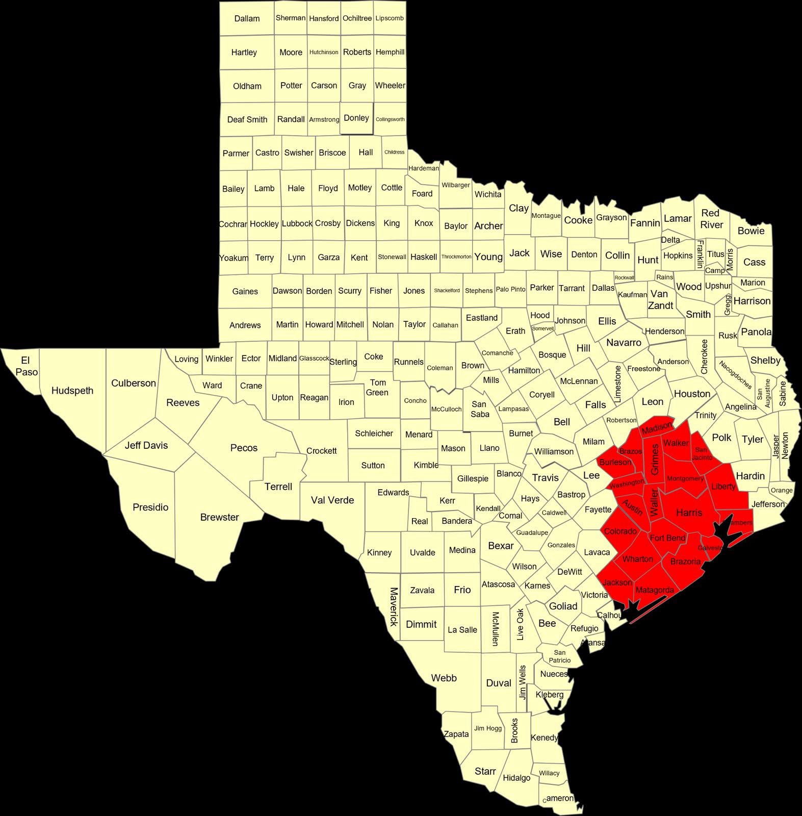
Madison-Walker-San Jacinto-Burleson-Brazos-Washington-Grimes-
Montgomery-Northern Liberty-Colorado-Austin-Waller-Inland Harris-
Chambers-Wharton-Fort Bend-Inland Jackson-Inland Matagorda-
Inland Brazoria-Inland Galveston-Southern Liberty-Coastal Harris-
Coastal Jackson-Coastal Matagorda-Coastal Brazoria-
Coastal Galveston-Matagorda Islands-Brazoria Islands-
Galveston Island-Bolivar Peninsula-
Including the cities of Madisonville, Huntsville, Shepherd,
Coldspring, Caldwell, Somerville, College Station, Bryan,
Brenham, Navasota, Conroe, The Woodlands, Liberty, Cleveland,
Dayton, Columbus, Eagle Lake, Weimar, Sealy, Bellville,
Hempstead, Prairie View, Brookshire, Waller, Houston, Winnie,
Mont Belvieu, Anahuac, Stowell, Old River-Winfree, El Campo,
Wharton, Missouri City, Mission Bend, Sugar Land, Rosenberg,
First Colony, Pecan Grove, Edna, Ganado, Bay City, Pearland,
Alvin, Angleton, League City, Friendswood, Devers, Pasadena,
Baytown, Palacios, Lake Jackson, Freeport, Clute, Texas City,
Dickinson, La Marque, Surfside Beach, and Galveston
1237 PM CDT Sat Mar 15 2025
…WIND ADVISORY IN EFFECT UNTIL 8 PM CDT THIS EVENING…
- WHAT…West winds 15 to 25 mph with gusts up to 40 mph.
- WHERE…Portions of south central and southeast Texas.
- WHEN…Until 8 PM CDT this evening.
- IMPACTS…Gusty winds could blow around unsecured objects.
Tree limbs could be blown down and a few power outages may
result. - ADDITIONAL DETAILS…drivers on north-south oriented roads
should use extra precaution.
PRECAUTIONARY/PREPAREDNESS ACTIONS…
Use extra caution when driving, especially if operating a high
profile vehicle. Secure outdoor objects.