BULLETIN – IMMEDIATE BROADCAST REQUESTED
Severe Thunderstorm Warning
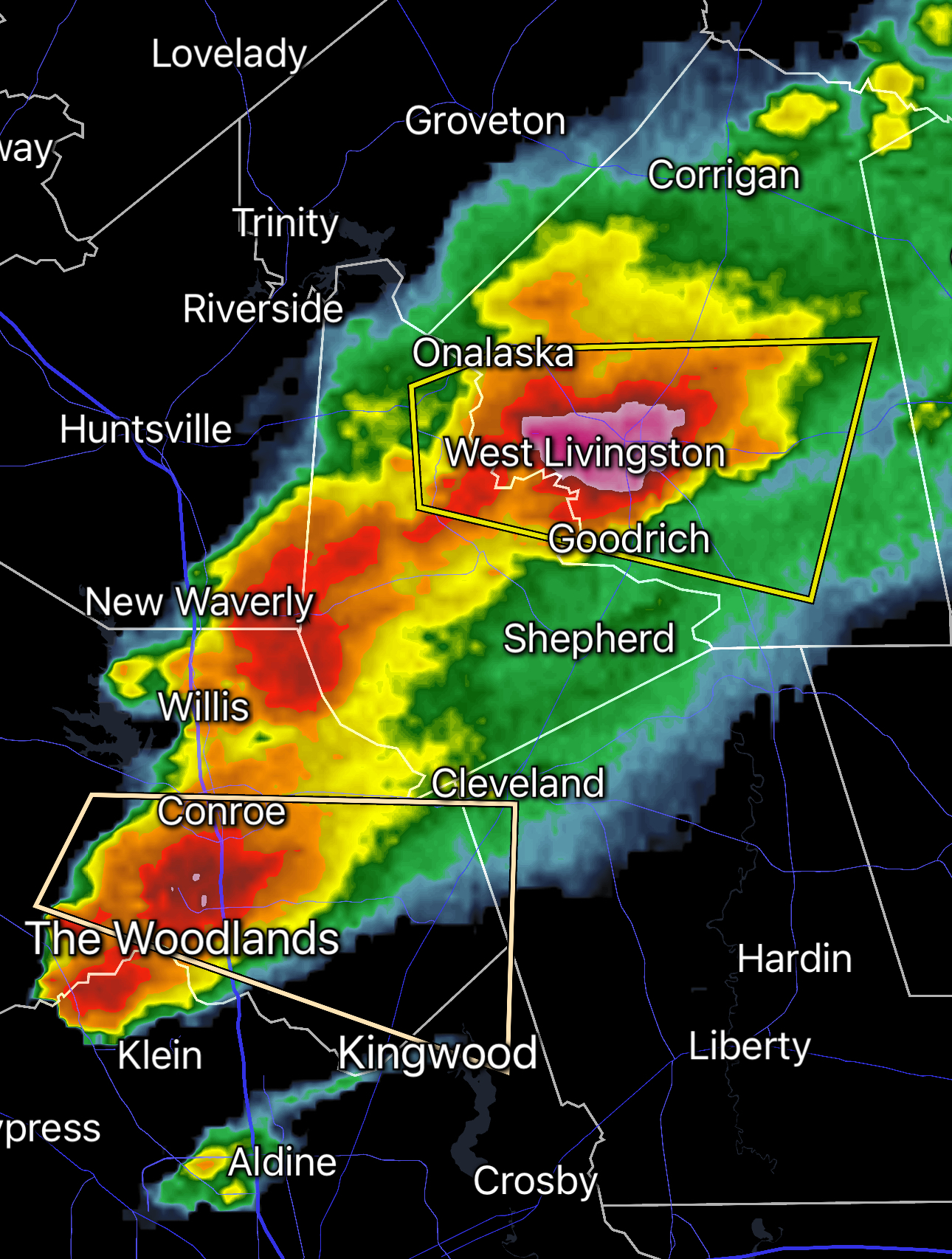
National Weather Service Houston/Galveston TX
403 PM CST Sat Mar 8 2025
The National Weather Service in League City has issued a
- Severe Thunderstorm Warning for…
Southwestern Trinity County in southeastern Texas…
Northwestern San Jacinto County in southeastern Texas…
South central Houston County in southeastern Texas…
Southeastern Madison County in southeastern Texas…
Northern Walker County in southeastern Texas… - Until 445 PM CST.
- At 402 PM CST, a severe thunderstorm was located 10 miles southeast
of Madisonville, moving east at 25 mph.
HAZARD…60 mph wind gusts and quarter size hail.
SOURCE…Radar indicated.
IMPACT…Hail damage to vehicles is expected. Expect wind damage
to roofs, siding, and trees.
- Locations impacted include…
Trinity and Riverside.
PRECAUTIONARY/PREPAREDNESS ACTIONS…
For your protection move to an interior room on the lowest floor of a
building.
Prepare immediately for large hail and deadly cloud to ground
lightning. Seek shelter inside a well-built structure. Stay away from
windows.
If on or near Lake Livingston, get away from the water and move
indoors or inside a vehicle. Remember, lightning can strike out to
15 miles from the parent thunderstorm. If you can hear thunder, you
are close enough to be struck by lightning. Move to safe shelter
now! Do not be caught on the water in a thunderstorm.
&&
LAT…LON 3081 9585 3095 9586 3108 9533 3081 9528
TIME…MOT…LOC 2202Z 260DEG 23KT 3089 9575
HAIL THREAT…RADAR INDICATED
MAX HAIL SIZE…1.00 IN
WIND THREAT…RADAR INDICATED
MAX WIND GUST…60 MPH